Go to CCP Homepage Go to Materials Page Go to Differential Calculus Materials Go to Table of Contents
Go Back One Page Go Forward One Page

Hiking and Climbing in Yosemite

Part 1: Reading a Contour Map

If you're not familiar with Yosemite National Park in northern California, click here for a map that will orient you to its location and major features. Close the map window or click on this window to return here. (Source for map: National Park Service Yosemite maps site.)

Our primary object of study in this module will be a contour map of a small portion of Yosemite Park, centering on Tenaya Canyon -- where real hiking (as opposed to our virtual activities) is dangerous and strongly discouraged.

Click here for the contour map. This link opens a new window for the map, and you may switch to that window whenever you need to. The scale of the map depends on the resolution of your screen -- it is marked in the upper left corner. The tick marks on the axes are at approximately 1000 foot intervals in the East-West and North-South directions.

You can locate coordinates for any point on the map by simply clicking on the point -- the coordinates appear at the top of the page just to the right of the map. These coordinates are measured in pixels from the lower left corner of the map, not from the origin of the fixed axes (north shore of Mirror Lake).

  1. Record the location of the origin in pixel coordinates -- as displayed when you open the map page. You will need to use these numbers to relate later measurements to the Mirror Lake origin.

In this part of the module, we will concentrate mainly on qualitative features of the map. Serious measurements start in the next part.

  1. Identify a cliff on the contour map. How can you use the contours to tell you how steep the cliff is?
  2. Identify two mountain tops. How can you use the contours for this? Record the approximate altitude of each peak.
  3. The following figure shows the famous Half Dome. How is this landscape related (if at all) to your answers to questions 2 and 3? (For additional pictures of Half Dome, visit the Virtual Yosemite site.)

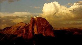
"Half Dome at Sunset", National Park Service Yosemite site
  1. Locate a saddle point, that is, a point at which the terrain is level, but from which you can go either up or down, depending on the direction you go. Give the altitude at the point on the terrain. What features on the map help you locate this point?
  2. What is the altitude at the shore of Mirror Lake? How would you locate a contour at this altitude?
  3. If you wanted to hike from Mirror Lake to the saddle point you found in step 5, what route would you take? Describe the trail as explicitly as you can, and describe any features of the terrain that might make this hike difficult. (For views of Mirror Lake, visit the Virtual Yosemite site.)

Go to CCP Homepage Go to Materials Page Go to Differential Calculus Materials Go to Table of Contents
Go Back One Page Go Forward One Page


| CCP Home | Materials | Multivariable Calculus | Module Contents | Back | Forward |

modules at math.duke.edu Copyright CCP and the author(s), 2001-2002